


Being able to accurately judge distance at sea is just as vital in the digital age as it ever was, says James Stevens. We look at how to refine your spatial awareness while onboard

How to judge distance at sea

James Stevens, author of the Yachtmaster Handbook, spent 10 of his 23 years at the RYA as Training Manager and Yachtmaster Chief Examiner
The universal use of GPS has made navigation simpler and improved safety at sea. Coupled with this revolution has been a fading of traditional navigation skills and observations.
When electronic navigation was widely introduced in the 1990s the RYA was very concerned about the potential abandonment of these navigation techniques, which are a backbone of the Yachtmaster syllabus.
This was mainly because of a lack of trust in a system which relies on signals from satellites 12,500 km away.
GPS proved to be much more reliable than we all feared, so only a minority of skippers get a pencil out to navigate these days.
However, there are some skills which are still relevant and helpful for judging position and distance at sea, even if they simply ensure the navigator is on deck rather than staring at a screen below.

Judging distance at sea tips: Navigational transits are as least as accurate as GPS. Credit: William Payne
This visual watch is important to avoid hazards which are not on the screen, such as other small craft and lobster pot floats.
It is also a fact that as sailors, we are navigating boats in the real world with physical hazards, not the virtual world.
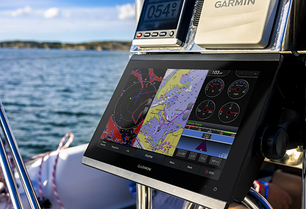
While it’s tempting to follow the boat icon across the chartplotter, it’s vital to remember that this is just a source of navigational information (albeit a very good one) to keep us safe in the real world.
Being able to translate what we see on screen to the marks, features and hazards around is a critical skill.
Conversely, being able to judge distance at sea helps us corroborate what we are seeing with what is on the chart, whether it’s electronic or on paper.

A vertical transit between the top of the Needles lighthouse and the barracks behind helps clear the Varvassi wreck. Credit: Graham Snook/Yachting Monthly
As an example, competitors in the Round the Island Race will know that there is a wreck, the Varvassi, about 110m out from the Needles lighthouse on the Isle of Wight.
To pass outside this hazard, use a transit which keeps the base of the Old Needles Battery above the top of the lighthouse.
This is a far simpler method of staying safe than having a crew member staring at a screen.
It also allows everyone to be on deck concentrating on the sail trim and probable spinnaker hoist as the yacht turns to the east.
Continues below…
How to choose the right digital charts for your sailing
There are big changes underway in the world of digital cartography, finds Sam Fortescue. We review the latest digital charts

8 tips for digital navigation
As with all aspects of navigation, following ‘best practice’ is the surest way to make sure you are passage planning…

Passage planning: Paper or electric?
We tend to consider paper charts the most reliable means of passage planning, but both electronic and paper options offer…

Tech focus: The future of the chartplotter
A new generation of chartplotters offers sailors more processing power than ever before. Sam Fortescue examines what you get when…
At night it can be difficult to estimate your distance off a single light, but in the case of, say, the Lizard, it’s important to stay at least three miles south in rough weather.
The technique of doubling the angle on the bow (explained below) allows you to do this using just a hand-bearing compass and the log, and there are plenty of other ways of being able to judge where you are on the water without having to consult your chartplotter.
Judging distance at sea: Transits
No matter how sophisticated the navigation suite on board is, by far the best way of entering and leaving a port across a tidal stream is by transit.
Most ports have transits which are easy to identify and follow. They are astonishingly accurate.
If you don’t believe this, look out of the window and line up two objects. Move across the room and watch them come out of alignment.
An accuracy of a metre or two is as good as GPS, it’s easy to use and keeps everyone alert.

Binoculars with a built-in compass will help you accurately identify a transit. Credit: Matt Knighton/Abu Dhabi Ocean Racing
Before using a charted transit, it is of course essential to identify it accurately and ensure that what you think is the breakwater really is the breakwater and not a row of houses.
A good pair of binoculars with a built in compass is useful in this instance.
Use the cursor on the chart plotter to find the bearing of the object from the yacht and you can point the binoculars directly at it.
You can of course use any two fixed objects as a transit rather than just the official ones, for example a buoy and a feature on the land behind.
This is really useful in places such as the Channel Islands and North Brittany where the tides are strong and there are buoys and off-lying rocks that can be several miles out.
Judging distance at sea: Collision avoidance
Judging the distance of a ship and whether it is a collision hazard is a skill.
An estimate by eye is always going to be approximate but with practice you can tell instantly whether the situation is getting dangerous.

If you can see a ship’s waterline it’s 3 miles away or less. At a modest 18 knots, it will reach you in 10 minutes. Credit: Graham Snook/Yachting Monthly
Most skippers understand that if the relative bearing of the ship stays the same, it is on a collision course.
When the ship is a long way off the bearing changes very slowly.

Bearing changes isnn’t the only visual tool to use in avoiding collisions. Credit: Graham Snook/Yachting Monthly
At three miles or so you need to have decided whether avoiding action is needed because a ship travelling at 18 knots will cover that distance in 10 minutes.
Large ships can be 40–70m tall, so they appear over the horizon about 15 to 20 miles away.
Judging distance at sea: Height of eye
With a height of eye of three metres, the horizon is 3.6 miles away (at two metres it is 2.9 miles). This means that if you can see the ship’s bow wave and waterline you are within this distance.
You might need binoculars.
Reeds Almanac has a table giving the distance of the horizon from different heights of eye.

When judging distance at sea, measure your height of eye on your own boat to get a precise distance to the horizon. Credit: Graham Snook/Yachting Monthly
It’s worth calculating your exact height of eye for your boat, and then checking the table so you have a precise range for your boat.
Being able to accurately judge how far away objects are in relation to the horizon is an incredibly useful ready-reckoning skill to have, and you can fine tune this by testing your judgement against measurements with AIS, radar, or on the chartplotter.

Distance tables will let you calculate how far off you will be when a light breaks the horizon. Credit: Maxine Heath
Most skippers use AIS and radar for collision avoidance, but almost every accident report of a collision emphasises the need for a good visual lookout.
Remember that vessels under 300 tonnes do not have to carry AIS; there are plenty of hazards that won’t show up on your screens.
Distance from land
Using the distance of horizon table you know that if you can see the surf at the base of the cliffs (on a moderate day) you are around 3 miles away.

If you can see people on land, you are inside one mile
If there are people on the coast path, you can see them with the naked eye from about 1 mile away. Any further than that and they won’t be discernable as people.
Rising and dipping distances of lights
You can obtain a fix from a single lighthouse at the moment when the light appears, or disappears on the horizon.
The chart or almanac will give the height of the light about Mean High Water Springs, and you need to estimate your height of eye on the yacht, usually two or three metres.
A table in the almanac will give you the distance off using these two figures, and a compass bearing will give a position line to give a fix.

There are plenty of hazards at sea that won’t appear on a chartplotter screen. Credit: Graham Snook/Yachting Monthly
The distance off will vary with the tidal height, so you need to work out the fall of the tide below MHWS and add it to the height of the light.
You can see lights further away at low water.
Rules of thumb
There are a number of other techniques which will give you a distance off which work best if you’ve tried them by confirming with the GPS after which you can get an instant answer.
Span of a hand
It was said that when entering Salcombe, sailing fishermen long ago would stay in the channel by holding the palm at arm’s length and if it just covered the adjacent cliffs they were on track.
I worked in Salcombe for four years and never met anyone who could confirm this but if you are close to a cliff and confirm your position electronically an outstretched arm with either fingers or hand covering the land will give you an instant estimate next time.

A hand width is roughly 10° wide. Credit: Graham Snook/Yachting Monthly
You have to be quite close for it to work.
My thumb held horizontally at arm’s length covers Fawley chimney, 198m, at a range of 1 mile.
Another technique used by hikers is to use the fact that your arm is about ten times the distance between your eyes.
For this to work you have to know the length of a building, a bay or some other object ashore.

A finger width is about 1°. Credit: Graham Snook/Yachting Monthly
With one eye closed align your thumb at arm’s length with, say, the end of a 100m long breakwater. Switch eyes with your thumb in the same position.
Your thumb moves along the breakwater. Say it moves halfway along, 50m. Multiply that by 10, and you are 500m away.
This is because the distance between your eyes is 5cm and from you eye to your thumb is about 50cm.
Doubling the angle on the bow
This is a useful technique if you are passing a feature such as a lighthouse and you need to keep a safe distance off.
Say there is a lighthouse on a headland on the south coast and three miles south of it are overfalls you wish to avoid.

The distance travelled between two bearings that double the angle off the bow is also the distance off you will pass the object. Credit: Alamy
As you approach the headland steering 090º you take a bearing of the lighthouse with a hand bearing compass. It’s 060º, or 30º to port of your heading.
You check the log and sail on an easterly heading until the light bears 030º, twice the original relative bearing from the yacht’s heading.
Whatever your distance travelled between the two bearings (corrected for tidal stream) is your distance from the lighthouse at the second bearing – hopefully more than three miles but if not you have time to alter course.
Rule of 1 in 60
When looking at bearings, if you know the range of an object or transit marks, you can use this to tell how far off track you are, thanks to the one in sixty rule.
This says that over 60 miles one degree of error will equate to being one mile out.

Measure the angular distance of the two charted objects to calculate your distance off
Conversely, over one mile, one degree is equal to a distance of 30 metres.
So a transit or bearing one mile away is meant to be 285ºM and your compass shows it as 280ºM, the 5º difference means you are 150 metres (5 x 30m) off track.
A version of this can be used with some binoculars that have vertical and horizontal angular measures.

0.4 miles (740m) measured as 8° equates to a range of 3 miles: (740/30)/8=3.08M. Credit: Maxine Heath
Roughly measure the angular distance of two objects.
If two navigation marks, 600m apart on the chart, appear 10º apart, you know that you are two roughly miles out. (10º at 1 mile = 300m and at 2 miles = 600m)
A seaman’s eye
In my experience the safest and best skippers have a ‘seaman’s eye’. They can spot trouble ahead in good time to take evasive action.
The trouble might be a lee shore, offlying rocks, a strong tidal stream in a confined channel, a fraying halyard or an approaching squall.
This ability to sense danger comes with experience and above all observing your environment and making sense of what you see.
It’s a great quality to have and it isn’t learnt from a screen.
Enjoyed reading Distance at Sea: Refine your spatial awareness?

A subscription to Yachting Monthly magazine costs around 40% less than the cover price.
Print and digital editions are available through Magazines Direct – where you can also find the latest deals.
YM is packed with information to help you get the most from your time on the water.
-
-
- Take your seamanship to the next level with tips, advice and skills from our experts
- Impartial in-depth reviews of the latest yachts and equipment
- Cruising guides to help you reach those dream destinations
-
Follow us on Facebook, Twitter and Instagram.