


Should sailors welcome or be worried by the expanding network of marine protected areas? asks Elaine Bunting
Marine protected areas: how the rules benefit sailors
Once the seas glimmered with dense shoals of herring, the ‘silver darlings’ pursued by a huge fishing fleet around our northern coasts.
Pilchards were so plentiful off the coast of Cornwall that an industry was built on them.
Industrialisation steadily changed that, but it was really only when people began exploring underwater that the full effects could be seen.
Below the surface, it was possible to study the lifecycles of marine organisms and appreciate their vast variety.
It became starkly obvious how easily these fragile habitats could be damaged, and a movement started to protect marine environments that continues today.
Fiona Crouch, a keen conservationist, went to New Zealand back in 1986, to volunteer at a marine reserve.

Fiona Crouch
It had been established in 1971 through the vision of Bill Ballantine, a marine biologist who had emigrated from the UK.
Ballantine had proposed a strict ‘no-take’ marine reserve at Cape Rodney-Okakari Point.
It was to become the first official marine reserve in the world. The idea was a pioneering one, but scientists around the world were already seeing the need to protect species and habitats.
In the UK, Britain’s first marine reserve was set up the same year, 1971, around Lundy in the Bristol Channel.
Other countries followed suit, and by 1985, there were more than 430 reserves around the world, albeit covering mainly small coastal areas.

New Zealand’s Cape Rodney-Okakri was the world’s first marine protected area. Credit: Alamy Stock Photo
By the 1990s virtually every coastal country had one or more marine reserves.
Yet many of these were not – and are still not – managed in any active way.
Fiona Crouch returned to the UK full of enthusiasm for strictly protected marine areas.
She had witnessed, first-hand, how marine life thrived in protected waters. ‘When I came back from New Zealand I thought, “We need these areas in the UK.” Yet we still haven’t got a proper no-take statutory marine reserve in the UK like the one I experienced at Cape Rodney-Okakari in New Zealand.’
A network of protection
Initially, marine areas fitted in a complex hierarchy of statutory protections, such as Sites of Special Scientific Interest (SSSIs), Special Areas of Conservation (SACs) and Nature Conservation Marine Protected Areas (NCMPAs).
It was a mish-mash, and experts could see that some areas needed marine protections for threatened species such as otters, whales, dolphins and basking sharks, and for dwindling seabed organisms.
In 2009, the Marine and Coastal Access Act was passed, committing the government to setting up a network of areas to protect and conserve marine species and habitats around the UK.
A three-year consultation process involved over a million people gathering information and providing opinion, and representations from stakeholders including the energy, fishing and leisure industries.

Dorset’s Studland Bay has become a testing ground for pragmatic management of conflicting interests. Credit: Alamy Stock Photo
At that point, some 127 sites around the UK were identified.
Today, around our coasts, 38% of UK waters are covered by a network of inshore and offshore Marine Protected Areas (MPAs) including Marine Conservation Zones (MCZs) and other areas covering 885km2 of UK waters.
Many of these are offshore and may define where development such as wind farms can happen, or were set up to protect certain species.
The south coast of England, however, is quite densely covered, with 87% of the Dorset coast within Marine Protected Areas and 67% of the coast between Chichester and Land’s End also protected.
A few of these abut large concentrations of leisure craft and one in particular has chafed – Studland Bay Marine Conservation Zone near Poole, and we’ll come back to that – but most are effectively ‘paper sharks’, little more than bureaucratic designations, and generally unmanaged.
Indeed, the only Marine Protected Areas that are meaningfully managed include those in Falmouth, Cawsand Bay near Plymouth, in Strangford Lough in Northern Ireland, Arran, the Firth of Lorn and Loch Creran.
There are also four No Take Zones, or NTZs, at the Medway Estuary, Flamborough Head in Yorkshire, and Lundy, where fishing is banned.
Overall, however, only 0.0024% of our Marine Protected Areas are fully protected from dredging and trawling, damaging practices which, according
to ecologists, profoundly reorganise seabed ecosystems.
However, in a tranche of proposed new highly protected areas, that is going to change.
Acronym alphabet soup
If you seek to understand what is behind all the different marine zones, you soon start to choke on alphabet soup.
Inside these areas how, exactly, are we to know where they are and which rules apply?
The short answer is that there are restrictions in very few areas.
Those rules that apply to anchoring and mooring generally come from local byelaws, or are voluntary.
The Marine Management Organisation (MMO), the statutory body with responsibility for English waters, has clarified that anchoring is a ‘normal and legal practice’.
In Scotland, anchoring is banned in the South Arran MPA (Lamlash), and moorings are provided as an alternative to dropping the hook.
The same restrictions applies in some (but not all) parts of the Marine Conservation Zone on the island of Skomer, which is just off the Welsh coast.
These are exceptions, but the fear is that there could be more restrictions elsewhere in the future.
Richard Hill, the RYA’s planning and environment officer, says, ‘The Marine Management Organisation is beginning to look at the specific management of Marine Conservation Zones for recreational use. Studland Bay will probably be the crucible of resolving how to manage marine recreation within Marine Conservation Zones.’

Richard Hill
Crucible is an apt word for the flashpoint that Studland has become.
The clash between conservationists, bureaucrats and boating interests at this beautiful and sheltered anchorage on the Dorset coast has been fierce – and predictable.
This is the closest anchorage to Poole Harbour, the home port of an estimated 4,000 to 5,000 pleasure craft.
In December, a voluntary no-anchor zone was introduced, which is to be extended in June 2022.
Studland Bay was designated a Marine Conservation Zone because of its extensive seagrass meadows, which provide a nursery for populations of pipefish, wrasses, seahorses and fish such as ray and sea bass.
The Marine Management Organisation says that if boaters don’t respect the voluntary zone, it will consider introducing byelaws banning anchoring altogether.

Snort-snouted seahorse: Studland’s controversial no-anchor zones will help protect this native species. Credit: Steve Trewhella/Alamy Stock Photo
‘This is about trying to avoid the problem of loving a place to death,’ says Richard Hill of the RYA. ‘The fundamental issue at Studland is that there is a boating community that would support conservation management – provided they are given some alternative.’
The controversy at Studland exactly illustrates a problem with bureaucratic designations.
If you are banning something, what are the reasonable, practical alternatives, and who funds them, creates them, maintains them?
A partial solution at Studland has been to lay ‘advanced moorings’ that do not scour the seabed, with an elastic rode attached to a helical screw anchor pile-driven into the seabed.
But the Marine Management Organisation is not proposing to provide these.
Instead the Seahorse Trust charity has stepped in and to date has put in 10 free-to-use moorings using this system.
One boat owners’ group argues out that these are suitable for only a narrow band of craft size and displacement.

Seagrass: Anchoring during the busy summer months may damage delicate beds of seagrass. Credit: Fiona Crouch
And so the debates rage on, although there has been more pragmatic progress since the National Trust has brought together a number of organisations, including the RYA, to work towards proposals for the sustainable use of Studland Bay.
Richard Hill comments: ‘The Marine Management Organisation is supposedly the statutory body. I think they should be providing a workable plan, not leaving it to a third party to come up with an application. That said, the RYA welcomes the latest developments and is working with the National Trust as part of the partnership on this. The issue of funding remains unresolved.
‘And this is the key question if it foreshadows other areas, because they are looking at “non-licensable” activities in other areas.’
Places identified as at risk from anchor damage include Kingmere Marine Conservation Zone, a small protected area near Worthing, and parts of the Thanet coast.
Hill says: ‘To be effective, the Marine Management Organisation needs to take the local community with them and resource whatever conservation measures are put in place. We would suggest Studland is a good example.’

Stalked jellyfish shelter in seagrass, using a sucker to attach, and eight tentacles to fee. Credit: Fiona Crouch
Alternatives to anchoring Studland is not the only area where there is a voluntary no-anchoring zone.
Others exist at Jennycliff Bay near Plymouth and Durgan on the Helford River.
There are also plans for a no-anchor zone to allow swimming and protect seagrass at Osborne Bay on the Isle of Wight.
These form part of a ‘Save our Seabed’ project, and Fiona Crouch, who became so impassioned about marine conservation in New Zealand all those years ago, has gone on to be a crucial player.
Since 2020, she has been Project Manager for LIFE Recreation ReMEDIES, a £2.5 million, four-year marine conservation partnership project to preserve the seabed at five Special Areas of Conservation at the Isles of Scilly, the Fal and Helford, Plymouth Sound and estuaries, and in the Solent and Essex estuaries.
The project has laid advanced moorings in Cawsand near Plymouth and off Yarmouth on the Isle of Wight.
‘We want to show that these work and are worth investing in,’ Crouch explains. ‘What we are trying to do is encourage the boating community to use the moorings, avoid anchoring and be environmentally aware. We’ve never said you can’t anchor in the seagrass, but hopefully we can change hearts and minds. Most of the boating community have been really supportive.’
As well as establishing new moorings the project has begun seeding new seagrass beds in Plymouth Sound, with the aim of restoring eight hectares.
Charting marine protected areas
A question you might well ask is where all these marine protected areas are exactly, what are the special rules you’d need to comply with and, if so, where (apart from Googling) would you find out about them?
‘Marking areas on charts would be one element of a broader, well-resourced information provision,’ says Richard Hill.
He says the RYA would like to see signage on mooring buoys in Marine Conservation Zones and at access points, for example at Poole Harbour, with information online. This is yet to come.
While most electronic charting software does set out areas with restrictions – Navionics, for example, marks and names all restricted areas with red-dotted lines – they are easy to miss and don’t detail notes of all restrictions that may apply.
At Studland, the charts simply say ‘Restricted area: Nature reserve’. Others read: ‘For more information, contact local authorities’.
An example of how it could work in future is the zoning in force in the marine park areas of the Great Barrier Reef in Australia.

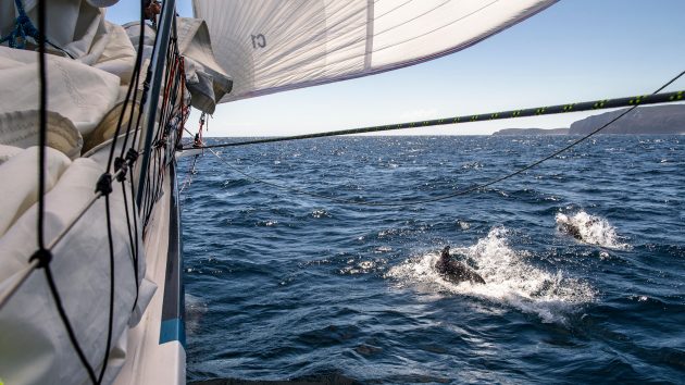
Some species, like common dolphin, are well-known, but in the last decade 2,000 marine species have been discovered every year. Credit: Angus Beare/Alamy Stock Photo
Designated as a ‘multi-use’ area by the Australian government, the authority responsible has created eight clear zones in the park and activities for use on chart, including ‘no-go, no-travel’ zones.
These are marked by different colours. C-Maps, for example, pick up on this information with a feature known as ‘shaded marine parks’, and show the relevant regulations in a chart items dialogue box.
But there is no standard or key worldwide, or in common use.
Need-to-know local information for sailors is still, however, the domain of the good, old-fashioned pilot book and sailing directions, such as Tom Cunliffe’s Shell Channel Pilot, Imray’s pilots to the West Country, the Irish Cruising Club sailing directions for Ireland or the Clyde Cruising Club’s pilots for Scottish waters.
To cruise without one of these indispensable paper volumes aboard would be madness for all sorts of good reasons.
If the sound of all these Marine Protected Areas, Marine Conservation Zones and Special Areas of Conservation and so on sounds daunting, a conversation with lifelong sailor and environmentalist Sarah Brown offers comfort.
Sarah Brown, used to manage The Green Blue, a joint environment programme developed by the RYA and British Marine.

Sarah Brown
She now works on a consultancy basis with Nature Scot, a statutory agency advising the Scottish government.
‘I would say that in Scotland there has been a lot of consultation and the RYA has been there every step of the way,’ she says.
‘The only place you’re not allowed to anchor here is in Lamlash Bay [Arran], which is a no-take zone, but there is nothing much ashore and there are moorings.’
There have been, she says, ‘good interactions with the Clyde Cruising Club and their sailing directions and if you look in most of the CCC publications it has been worked in. Honestly, if you look at the marine protected areas advice, you’d really have to be going out of your way to get into trouble. As long as you stick to the designated anchorages, which are all marked on the chart, and have all been assessed, the main concerns would be whether you are moving invasive species around on your boat, and providing a hitchhiking platform for them.’
For Brown, the bigger issue is not causing harm to wildlife.
‘If you see whales, basking sharks or dolphins, slow down. Avoid nesting areas,’ she says. ‘Slow down if you see any cetaceans in the area and avoid any disturbances. ‘Don’t disturb a sensitive species. Don’t pursue a pod of dolphins – that’s against the law. If you are in an isolated anchorage and you see a sea eagle’s nest don’t go ashore and land your dinghy to go and watch it.
‘But,’ she adds, ‘People are getting wiser. A big part of sailing in Scotland is seeing the wildlife and that’s why I welcome it.’
She suggests sailors should reframe themselves as advocates and champions, and would like to see us play ‘more of a role in logging wildlife and reporting suspicious activities. We should be getting on the phone if we see oil spills or illegal activities or wildlife disturbance.’
‘Throughout my working life I have been out there giving talks about wildlife and it is fascinating how excited people get when they tell you about a wildlife experience,’ she adds. ‘People just light up and you can see the joy in the faces. The more advocates we get, the better behaviour, reporting and involvement we can get.’
A problem with fishing?
If government is serious about marine conservation, it needs to consider the costs of fishing practices.
‘The fishing industry has been very effective at lobbying but it is true they are fishing down the food chain. There is a lot of trawling for prawn and that is very damaging,’ explains Sarah Brown.
The fishing industry, so vital to coastal communities, has already had to absorb multiple byelaws with trawl-and-dredge bans, but there will be more.
The UK government has committed to identifying and designating pilot Highly Protected Marine Areas (HPMAs) by the end of this year.
In these, extraction, depositing and fishing will be banned. Only non-damaging activities would be allowed, such as sailing, scuba diving and kayaking.
This network will contribute to a ‘blue belt’ around the UK. Many experts and marine biologists say that strictly protected zones help replenish our seas, and there is good data to back this up.
Continues below…

Voluntary no anchor zone for Studland Bay
A voluntary no anchor zone will be introduced at Studland Bay in Dorset from December 2021 before it is extended…

Sailing wildlife: 10 best British spots to see various species
One of the great pleasures of cruising the waters of the British Isles are sailing wildlife encounters. The diversity of…

A sailor’s guide to whales and dolphins
Spotting wild whales and dolphins while sailing is a joy, says marine conservationist Anna Moscrop

Eco friendly sailing: Best practice for green yachting
How easy is it to go eco friendly sailing? We look at the steps cruisers can take to minimise their…
The small no-take zone set up in Arran in 2008 has led to a four-fold increase in lobsters and a revival in many species of molluscs and fish.
Lobsters produce six times more eggs in the zone, creating valuable overspill to areas that can be fished.
Globally, marine conservation is a hot topic.
Documentaries from The Blue Planet to My Octopus Teacher have opened our eyes to the mysterious, sentient creatures living beneath the surface.
The Marine Conservation Society would like to see proper management of marine protected areas and and marine protected zones here, as there are in many other places in the world.
It would also like to see ‘at least 30% of the world’s ocean highly protected by 2030’ to conserve species and to preserve the ocean’s ability to process carbon dioxide.
How these regulations are implemented, and by whom, may be up for debate, but the necessity for a plan is beyond doubt.
Our seas have truly been plundered.
Marine Protection Areas: Your questions answered
How many protected marine areas are there in the UK?
There are currently 371 Marine Protected Areas (MPAs) in the UK that include Special Protection Areas, Marine Nature Reserves, SSSIs, No Take Zones and Marine Conservation Zones (MCZs) in England.
MCZs were set up in 2009 and have a higher level of protection for important marine wildlife, habitats, geology and geomorphology. There are 91 MCZs.
They will be supplemented soon by Highly Protected Marine Areas.
Ireland is looking at defining its Marine Protected Areas (MPAs), and has a network of Special Areas of Conservation and Special Protection Areas (www.npws.ie).
Where are they?
All around the coasts of England, Wales, Scotland and Northern Ireland and offshore into the North Sea and Atlantic.

There may be many marine protected areas, but very few restrictions for sailors. Credit: www.JNCC.gov.uk
An interactive map of these can be seen on the mapper tool at www.jncc.gov.uk
This also shows the features and species that are being protected in Ireland.
Who is in charge?
In the UK, inshore areas are generally managed by various nature conservation bodies in conjunction with the Joint Nature Conservation Committee. Offshore they fall under the remit of the Marine Management Organisation, the government’s principal regulator.
Which restrictions apply to me?
The best way to find out the current situation in your intended cruising areas is from an up-to-date sailing directions and pilot book or by researching site rules and byelaws online in advance of your passage.
It is only a rare few that have restrictions on boating or anchoring.
Enjoyed reading Marine protected areas: how the rules benefit sailors?

A subscription to Yachting Monthly magazine costs around 40% less than the cover price.
Print and digital editions are available through Magazines Direct – where you can also find the latest deals.
YM is packed with information to help you get the most from your time on the water.
-
-
- Take your seamanship to the next level with tips, advice and skills from our experts
- Impartial in-depth reviews of the latest yachts and equipment
- Cruising guides to help you reach those dream destinations
-
Follow us on Facebook, Twitter and Instagram.